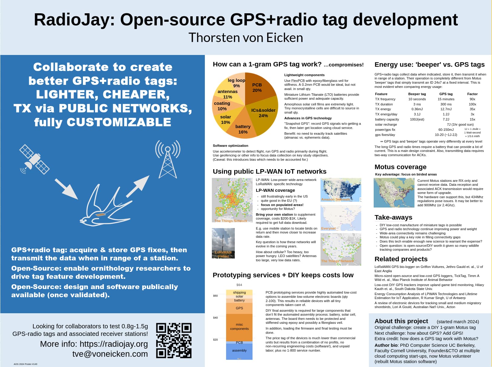
Sometime in march someone asked what it would take to make DIY/open-source tags for Motus and I wondered “hmmm, lemme try…”
This soon morphed into wondering what it would take to add altimeter data to the tag transmissions in the context of tracking bird collision risks around ocean wind farms.
It’s now a bit over half a year later and I’m reaching a milestone, which is an AOS 2024 conference poster presentation next week ![]() .
.
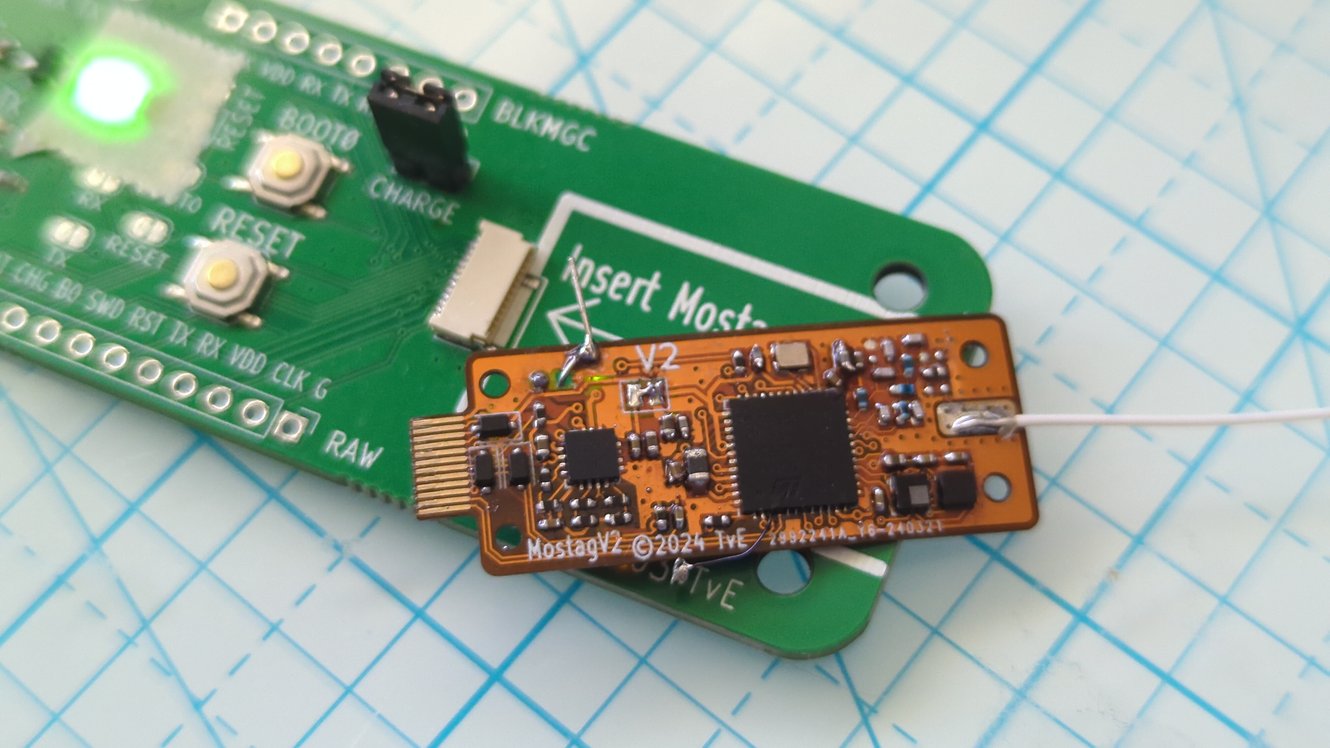
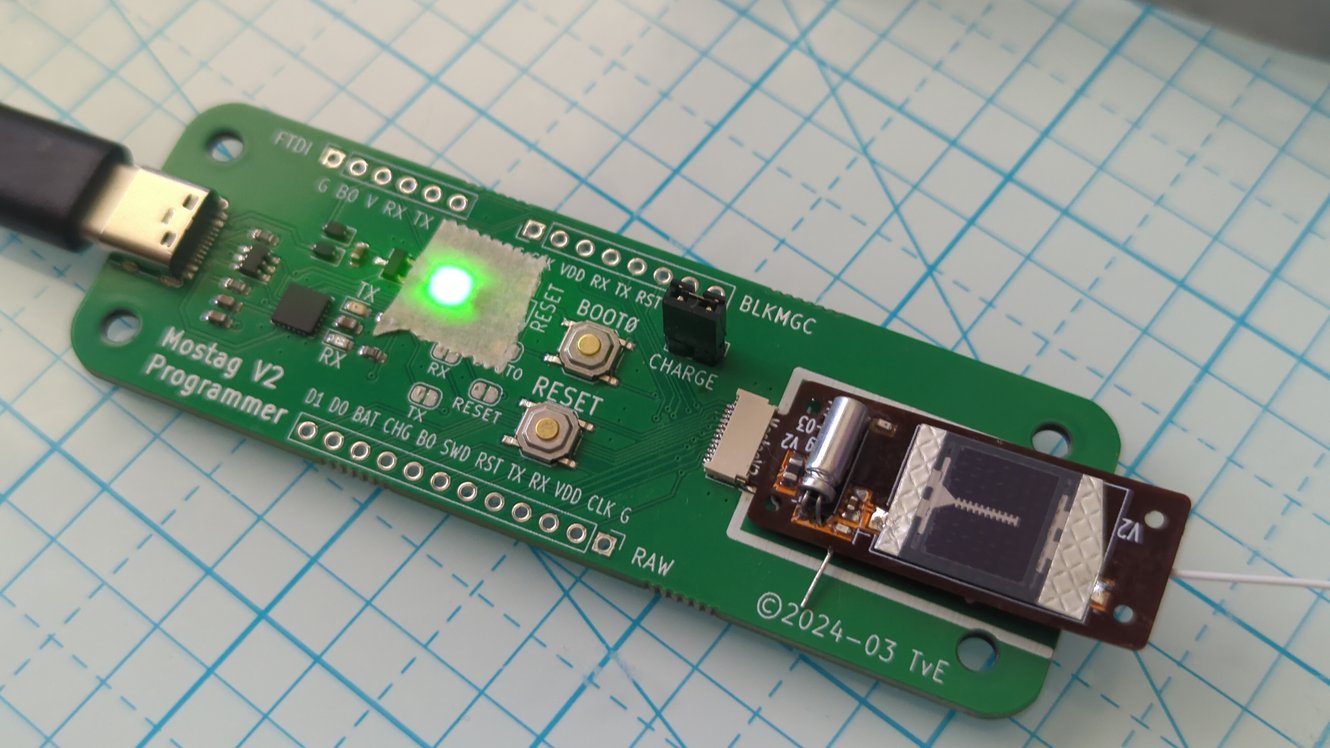
What I’ve done since march is to produce a small number of 1 gram tags that are fully Motus compatible (433Mhz) and have a pressure sensor as well as an accelerometer on-board. At each ‘beep’ the tags transmit their ID and the pressure reading, from which the flight altitude can be estimated. Here are two photos of a tag laying on top of a programmer board and inserted into the programmer:
In this process the three main learnings were:
- it’s indeed possible to make sophisticated DIY tags that weigh 1 gram and cost only $30-$60 a piece
- it’s possible to extend the 434Mhz protocol in a backwards compatible manner
- the really interesting question here is how useful the real-time data is
There’s a huge divide between tags that transmit real-time data, which is lost if the transmission is not received, and tags that store sensor data and upload it via radio when in range of a station. I got the impression that the real-time data works to study collision risk around wind turbines but not for many (most?) other studies due to the fact that it’s difficult to ensure a reasonably continuous data set.
(Maybe this is a good time to insert a disclaimer: I have a PhD but it’s in computer science, not ornithology, so I know nothin’ about bird-related studies!)
All this lead me to wonder: how about replacing that altimeter by a GPS? (There are good reasons to have both, but that’s another topic.) Long story and lots of testing of latest generation GPS devices later I’m pretty convinced it’s possible to make 1 gram GPS tags that upload the data via radio when in range of a station. Moreover, I believe it’s totally feasible to upload to emerging public LPWAN networks (Low-Power Wide-Area Networks). I don’t have such a tag made yet so it’s still in the “I believe” category: I’ll find out in the coming weeks…
Overall I’m interested in figuring out whether I can help projects with new tags and how new localization technologies like snapshot GPS can work with Motus. All this is non-commercial.
If you are interested in this topic I’d love to hear your ideas, especially if you might be interested in collaborating to test some 1g-1.5g GPS tags in the near future! If you are going to AOS 2024 please stop by at the poster session (wed evening) or at any other time, if you won’t be there please get in touch here!
All the info is available at https://radiojay.org : details about the tag development as well as a couple of whitepapers on topics around the technology, including some of the options I see around Motus. (Keep in mind that I’m just a volunteer, not affiliated with Motus HQ.)